Cycling in Sastamala
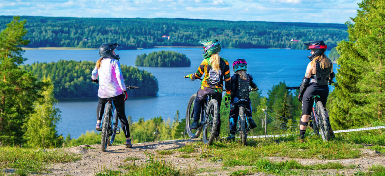
Cycling is a popular way to get around locally and in nature. While cycling you can admire Sastamala's beautiful scenery at your own pace and get some exercise.
This page gathers routes of about 20–40 kilometres that let you explore Sastamala’s landscapes and other sights worth seeing. The routes’ lengths and markings for road surfacing can be found on the maps. Along the way places such as attractions, cafés, eateries and swimming spots are marked. However, remember to always check opening hours for especially summer destinations from the destinations’ own channels.
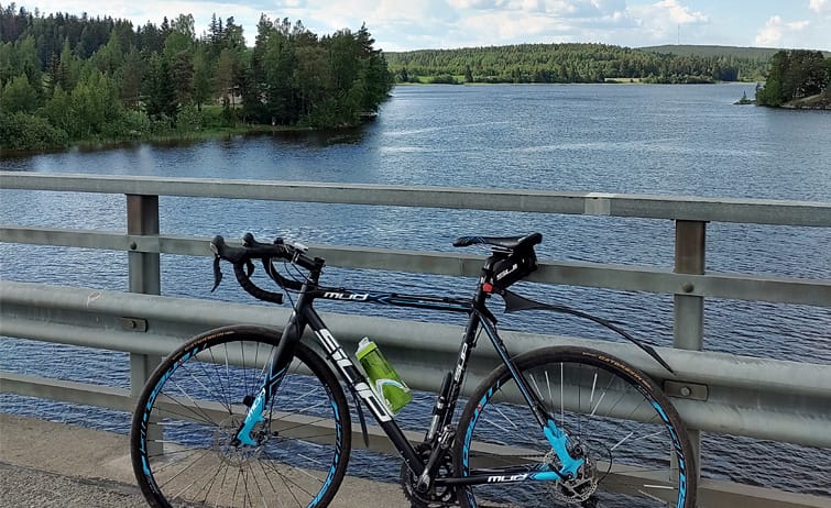
On the routes you can enjoy, for example, the lake views of Rautavesi or Liekovesi, the rugged terrain of Ellivuori and Häijää, or the idyllic countryside of the villages.
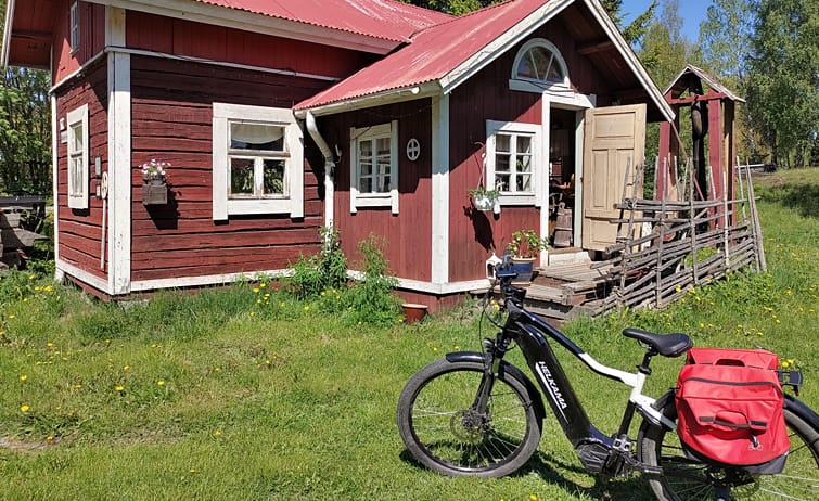
Bikes in Sastamala are rented, for example, by Sastamarine, Nettomatti in Sastamala town centre (Vammala) and Ellivuori Resort.
Lake routes in Sastamala
Sastamala is part of the Lake Routes, which expanded from the PyhäNäsi routes, on the Rautareitti (Iron Route), which is divided into Kulovesi and Rautavesi circuits. Maps of the lake routes are available online as well as in printed form. Numerous places for short stops and accommodation are marked along the routes. Read more on the site www.jarvienreitti.fi/rautareitti.
Below are the routes with short descriptions. The map for each route can be found by clicking the map link.
Ellivuori-Otamus-Häijää route
Ellivuori-Otamus-Häijää route runs through rugged and forested terrain in the picturesque landscapes of Ellivuori, Otamus and Häijää, mostly on gravel roads. Häijää has a diverse service centre with shops and restaurants, and in summer you can stop along the way for a coffee at the Otamus café. Otamus also has nature trails and a lean-to, and from there there is a connection via Siuro to the Pyhäjärvi route that is part of the Lake Routes.
Ellivuori-Ritajärvi route
Ellivuori-Ritajärvi route goes from Ellivuori to the popular outdoor trails of the Ritajärvi Nature Reserve. Along the way you can top up your packed lunch at Karkku Village Shop and enjoy it at the Ritajärvi rest spots. Ellivuori has a hotel, a restaurant, activities (e.g. an adventure park, mini golf, stand-up paddleboards, etc.), as well as the spectacular Pirunvuori viewpoints and the artist’s studio Pirunvuoren Kivilinna.
Six Bridges Loop (Ellivuori-Kutala-Kärppälä)
Six Bridges Loop circles the islands of Kulo and Rautavesi in an idyllic rural landscape. You cross the water as many as six times when going from Karkunkylä to Salonsaari, Isosaari, via the mainland to Kutalansaari and back to the mainland at Kärppäläntie. In summer a kiosk, Kutalan Kasino, serves along the route and hosts various events throughout the season. From the route there is a connection via Tottijärvi to the Pyhäjärvi route of the PyhäNäsi network.
Suspension Bridge Route (Liekovesi-Keikyä Suspension Bridge route)
From the west side of Vammala town centre, along the Kokemäenjoki river landscapes starting from Liekovesi, runs the Liekovesi-Keikyä Suspension Bridge route, on which you can alternatively circle only Liekovesi and cross the Kokemäenjoki at Kiikka to return to Vammala from the other side of the lake, or continue along the Kokemäenjoki all the way to Keikyä and cross the river via the Keikyä Suspension Bridge pedestrian and cycleway. Keikyä Suspension Bridge is Finland’s longest wooden suspension bridge, which was restored by volunteers during 2020. Keikyäntie also has an ancient whipping place along the road that you can go and see.
Rautaveden circuit
The popular Rautaveden Circuit runs through the cultural landscapes of Rautavesi from Sastamala town centre near the old stone churches to Karkku and back via Ellivuori. The circuit goes through Sastamala’s town centre, Vammala, along the shores. There are several pleasant food and café spots as well as swimming places on the route. The Rautaveden Circuit is very hilly terrain and is also the route of the Rautavesi Marathon.
Sastamala church pilgrimage (Saint Olaf route in Sastamala)
The Sastamala church pilgrimage has been walked since 2006 and is part of the Saint Olaf land route, which runs through Sastamala across Finland and connects to the Saint Olaf waterway and a larger international network. The exact route map is in the Lipas service.
Stormi-Houhajärvi route
Stormi-Houhajärvi route is dominated by beautiful rural landscapes of fields, forests and villages. The terrain is flatter than the northern parts of Rautavesi, although in Kaltsila you encounter steep cliff edges along the way (this route is found in the Lipas service). Stormi-Houhajärvi route runs along the south side of Houhajärvi. GPX map Stormi-Houhajärvi in LIPAS – Liikuntapaikoissa
From Liekovesi to Vaunujoki (Vaununperä-Kaukola-Tyrväänkylä route)
The northern part of the Vaununperä-Kaukola-Tyrväänkylä route, which passes through Vammala town centre, is mostly flat countryside shaped by Liekovesi, Vaunujoki and the Kokemäenjoki river, while the southern part goes along the village road that runs through Tyrväänkylä. The route goes through Sastamala’s centre along the shores, so you can stop for, say, an ice cream.
Downloadable and printable route map of the Ellivuori area: EllivuoriResort_luontoreittien reittikartta
Welcome Cyclist badge
The Welcome Cyclist badge is designed to make a cyclist’s life easier when they are looking for suitable services: those places and services where a cyclist knows they are always welcome, and which offer a little better services to someone travelling by bike.
The Finnish Welcome Cyclist badge is not a heavy certification; a company can use it by offering a few cyclist-friendly services that cyclists appreciate. Companies that receive the badge are also listed on the bikeland.fi map of cyclist-friendly services bikeland.fi -map.
In Sastamala the Welcome Cyclist badge can be found at Majatalo Liekoranta, B&B Kommee Kurki, Herkkujuustola’s Juustotupa and Simula farm.
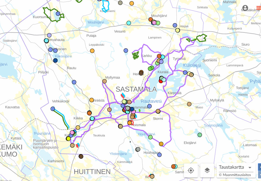
Sastamala’s cycling routes can also be found on Retkikartta and the national Lipas service, which provides up-to-date information on Finland’s public sports facilities. From there you can download the route map in .gpx format to your navigation app, such as Sports Tracker or Karttaselain. Click the location to get more details.
Screenshot from the Lipas service with the “Sastamala” area